For this section of the Hume & Hovell Walking Track, we put this on as the very first walk of the 2011 week and my original thoughts were that we would utilise a 'Car Shuffle' so we could walk in at the northern end of the reservoir and exit at the southern end. However, this was not to be (which leaves the southern section open to be explored at a future date). Instead we would be walking in from the Blowering Dam Wall and hopefully reach Browns Campsite, about 8km away, then return to the cars by the same route we had walked in on.
We drove out to Tumut in our cars, I was using my Rav4 to transport Liz and Denise. It was a 45 minute drive into Tumut and then to the car park at the Blowering Dam wall, (a distance of 68km) arriving there at 10.00am. A perfect cool sunny day with very little cloud was there to greet us. Overall there was the full compliment of 31 Shoalhaven Bushwalkers. Lauri showed us where the Hume and Hovell Track came in from the north at the dam and after taking a number of photographs of the water, dam wall and the reservoir itself, we set off south along the western bank of Blowering Reservoir.
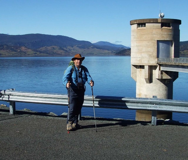
Paul standing on the Blowering Dam Wall with the reservoir
in the background prior to the commencement of the walk
Photo by Tony Simmonds
We hadn't walked more than 200 metres when we came across Blowering Campsite, a rather small, but adequate camping area on the track. It had pit toilets, a water tank and sheltered seating with table. Quite excellent facilities for the long distance hiker. We moved off, following the track until it veered off on a right hand tangent along the top of the embankment. The vegetation seemed to be mostly a mix of pine forest and native eucalypt, with smatterings of hakea. Because the dam wall had been improved to hold another two metres of water, the foreshore contained a two metre high line of dead and dying trees, drowned during the recent wet summer. With the waterline now receding the trees now becoming dry skeletons of brown on an otherwise green background. The recent wet summer had also seen changes made to the track with a notice informing walkers of the closure of the track between Browns Campsite and Paddys River. This was not good news, and for someone who is hoping to walk the entire track from Wee Jasper to at least Woomargma or even Albury, it puts a complete stop. The track has been ruined by water run-off from storms and includes bad erosion and damage to bridges. One can only guess when the track will be open again.
Our early section of the walk was very scenic with great views of the dam wall from the reservoir side and the surrounding hills and mountains reflected in the water. Many photographs were taken during the walk in along this section. The track itself was well defined, but very narrow and in places just a little overgrown, but no problem in negotiation. Being stuck at the rear of 30 mostly elderly walkers though was no fun. Jock, always 'Tail End Charlie' was quite at home, as was Tony and Bev, but I was itching to stretch the legs out and gain some decent walking pace to burn off some calories and I became frustrated as many times the line seemed to stop and it felt like I was in a traffic jam. It was only Lauri revealing some point of interest or asking if this was a good place to stop for morning tea - we had only just commenced walking. Someone just in front of me commented that the spot was not suitable due to the rather large 'Bull Ants' nest sitting in the middle of the track - and the ants were getting very agitated. About 100 metres further on we did stop for a morning tea break for just on 15 minutes before we moved off again.
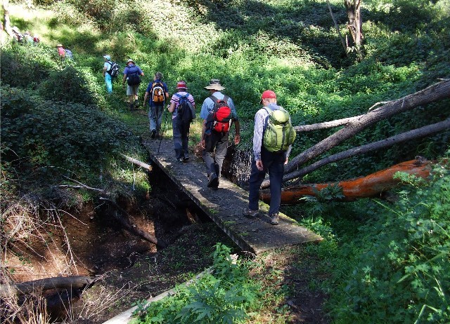
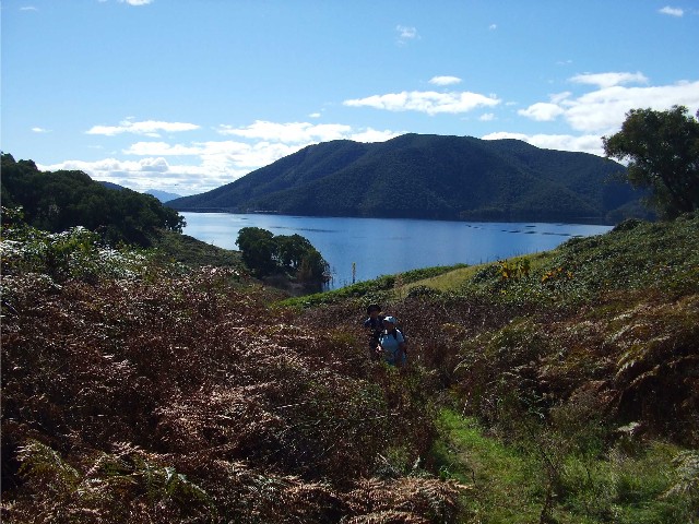
Shoalhaven Bushwalkers crossing a footbridge over one
of the small feeder creeks near an inlet.
Tony conspicuous at the back with his red cap. Interesting
red lichens on the tree trunk to the right
The track continued to provide picture postcard views of the reservoir and its surrounding hills and mountains. The track undulated quite well, providing sections of steep ascents followed by a length of flat terrain followed by a handy descent as we crossed each headland. There were sections of grassy embankments that invited curiosity to what was over the rise above us. The track itself soon headed inland as we made our way around a number of small inlets, crossing the end of one via a small wooden footbridge before again ascending to a grassy and rocky outcrop, before again descending another small hillock. It was around this time that a couple of our elderly walkers decided the walk was above their abilities and volunteered to stay behind. As we were basically walking in and out via the same route Lauri had informed many of the group that there was no problem with anyone withdrawing from the walk. No one could get lost on this section of track, though on the next rise I was surprised to notice a side track heading off into the bush where the track changed direction. Even so, you would have to be an idiot to head off on this side track, the main track being much more well defined.
The track now returned to the shoreline of the reservoir across open countryside that was once dairy and sheep farming land. There was also several young looking fig trees along here, all showing early fruit. We descended a short distance before the track then ascended away from the shoreline, though a huge stand of blackberry bushes, still in fruit, but only just. We seemed to be heading away from the water and into forest and once again we had stopped. A front runner group had gone ahead to judge how close we were to Browns Campsite, our planned lunch stop on the walk, just 8.6km from our starting point. They returned with bad news that there was no immediate sign of the campsite and the track was in disrepair. It was decided to stop here for lunch. The area was in forest but had an open grassy sunlit ground cover. It was comfortable. It was only 12.20pm and someone had estimated (Obviously via a pedometer) that we had walked 6km.
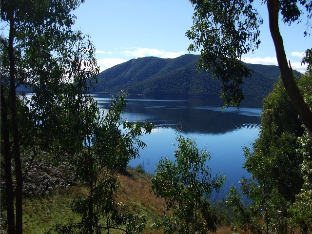
One of my favourite photographs of the Blowering Reservoir from the Hume & Hovell Walking Track
With lunch eaten I was quickly standing up and had my rucksack shouldered and I heard Lauri state "Off we go" so, with the chance of being in front, I headed out at a pace I found most comfortable. This was what I wanted, a chance to stride out and put some pace on as I made my way back to the car park at the dam wall. I decided to hit a good steady rhythm and see how long I could go before I commenced huffing and puffing. Surprisingly it wasn't long. The chest infection and head cold I had recently come down with was taking its toll, though I did find the going much easier the further I went. I also noticed I had pulled well clear of the walking group. I couldn't hear a single voice - all nice and quiet and on my lonesome, it felt great, just like a solo bushwalk. My feet though were starting to hurt a bit. It had been almost 2 years since I'd worn my best bushwalking boots and I could feel my feet sliding around inside (despite wearing 2 pairs of socks) I think I was paying a late price for the recent Canberra Walking Weekend Marathon too as the old blistered skin from that walk felt like it was coming loose and a new blister was forming. I stopped to adjust my laces and immediately my feet felt better.
I upped my pace again and soon crossed the small wooden bridge at the inlet. As I made my way around the headland I stopped to look back across the water and saw nothing, just the foot track on the other side. I did hear chattering though, just faintly and soon enough saw several of the walking group coming into view. I had got quite well ahead and decided to press on. I was expecting to catch up to those who had pulled out earlier very shortly and decided to try to catch up to them to see how they were going. The Blowering Dam Wall didn't seem to be getting any closer, but then I hadnít been taking much notice of how far away it was. I continued on, eating up the metres and as I came to the ledge that leads to Blowering Camp I could see them. They had almost made it back. I was surprised to find the group had grown to four walkers and caught up to them just metres from the campsite. Here we all stopped and waited for the others to catch up.
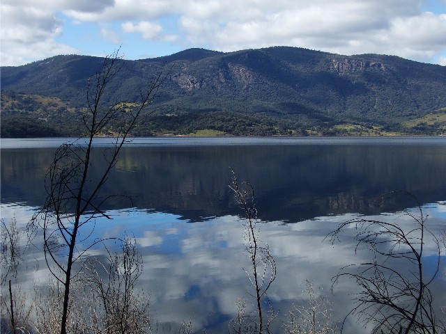
Looking across the reservoir to reflections in the almost still water
Everyone was totally surprised to see Alan Roper turn up just 5 minutes later. I had been aware that Alan had been about 100-200 metres behind me during some of the open sections for most of the walk, but I had lost sight of him through the thicker scrub. Not bad for an 80 year old. We sat talking about the walk for some time and it would have been 15 minutes later that my eyesight was drawn to the waterline where I could see the reflections of bushwalkers walking along the track and sure enough, the greater number of our group soon joined us. We made our way back to the car park where it was decided we would walk across the top of the Blowering Dam wall to take in the views.
The Blowering Dam was built during the Snowy Mountains Scheme during the 1950's. It is an earthen dam (soil and rocks making up most of its structure) and we believe it's turbines provide electricity for the town of Tumut. There are some great views from the top, looking down the Tumut River towards the local trout farm (which can be seen from this vantage point) At the far end is what Harry Hill's book calls "The skateboard ramp to surpass all skateboard ramps". This is the concrete spillway that has seen an overflow just a couple of times since the dam was built. There is also a picture and information on Ken Warby's water speed record that was created on the reservoir in October 1978 - a record that stands to this day. We returned to our cars for the drive back to Laurel Hill at 3.45pm.
Pam and Kerrie heading inland on the track just before
our lunchtime stop