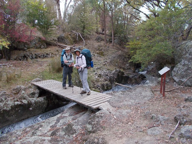
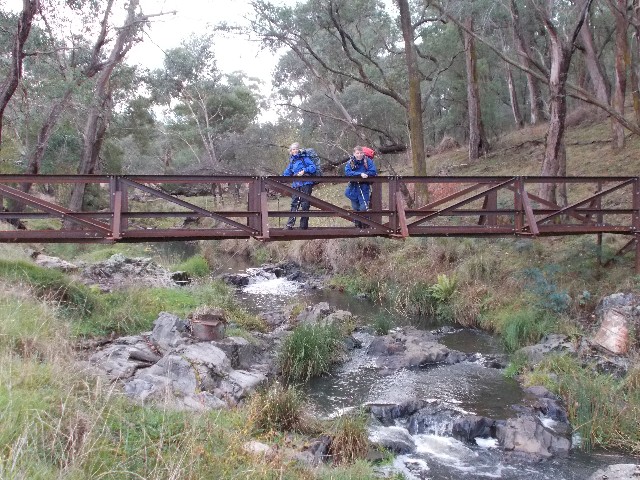
Squizz and Jennifer at Burra Creek crossing where miners once blasted a channel through the rock
Part 4: Tumbarumba to Albury
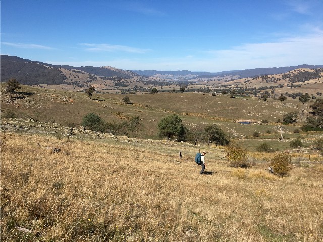
Again I am walking in familiar country as the first six kilometres will take us along a walking track I have followed numerous times with the Shoalhaven Bushwalkers when we stay at nearby Laurel Hill Forest Lodge. The track is well defined and is full of historical interest as we pass areas that were mined for gold or featured places where Hume and Hovell walked on their expedition. There were areas where gold miners had created creek embankments with rock collected during their mining operations and clear evidence of blasting a channel through rock to divert the waters of Burra Creek. Further on a tunnel has been created through a hill and Burra Creek now flows through this. A little further downstream we pass by picturesque cascades that were recorded in Hume and Hovell's journals as they came past, choosing one spot along here to camp the night.
Squizz and Jennifer at Burra Creek crossing where miners once blasted a channel through the rock
After following a benched track alongside a ridge above Burra Creek we turn off and ascend a rough track to arrive at Big Hill at 9.40am for a 15 minute break. It was here that Hume and Hovell first set eyes on the Australian Alps and despite today's misty conditions we can still see Mounts Kosciuszko and Townsend in the distance. Returning to the track we descend the 500 metres through the bush to reach Tumbarumba Creek and we cross the steel swing bridge to the other side. This bridge is much smaller than the Jack Cribb Bridge over the Goobarragandra River we used earlier in the walk and a lot more stable. It replaced the old wooden footbridge that was destroyed and washed away during the 2011 floods.
On the other side of the creek is another logbook. Squizz again wrote in our details, though his poetic license appears to have dried up just lately. We now follow the track which ascends narrowly and steeply into Bogandyera Nature Reserve. The track is still well defined but provided us with the hardest walking since the ascent to Buddong Falls. We ascended alongside a steep gully and around a large hill. We stopped for 30 minutes at 12.25pm at the 12km post for lunch before continuing. The forest was cool up on the ridge but we continued to ascend until we crossed a logging road which we believe is the Mount Garland Trail, then the track continued pleasantly through the forest until we ascended the top of a rise and caught our first glimpse of Mannus Lake below through the trees. We descended quite quickly to the new metal bridge and crossed it before following an avenue of trees between two paddocks to arrive at Mannus Lake Road on the eastern shoreline of the lake right next to the Mannus Lake B&B. We followed the gravel road to Mannus Lake Campsite arriving there at 2.10pm.

Paul crosses Tumbarumba Creek using the new swing bridge. Photo: J Himmelreich
Afternoon tea was enjoyed looking at the lake and historic mining equipment in the picnic area. A group of workers from the nearby correctional facility were nearby and this site is testament to their work. We decide to top up our water here from the water tank, though I filled my water bag, the others grabbed enough for the next section to Mannus Camp which is 5km away and has a running creek beside the tent sites.
We now continued northwards alongside Mannus Lake. At first we followed a bush track on the lake's edge, including a very nice boardwalk over swampy ground, but the fun ended after a few hundred metres. We suddenly found ourselves back on Mannus Lake Road and it was a real trudge - dusty, hard gravel and nothing of interest to see. Squizz forged well ahead and we didn't see him again until we arrived at Mannus Camp. It was one of the few times he managed to leave me in his wake. By the time Squizz sped off Jennifer was starting to slow down and struggled on the hard gravel road. I stayed back and kept myself in her sights as best I could. Squizz later apologised for not waiting at one of the intersections, but it was obvious which way we had to go and I could understand his desire to get this horrible boring stretch of road behind him.
At 3.55pm Jennifer and I arrived at Mannus Camp which is situated on the intersection of Mannus Lake Road and the busy Jingellic Road where logging trucks roared past 24 hours a day. I was very disappointed with Mannus Camp, the toilet block was across the road from the campsite. The site itself had obviously been recently used by the local farmer to graze cattle and there were cowpats all over the site. Worse still, there was cattle dung in the main water supply. I was suddenly very grateful to have filled up my water bag at Mannus Lake Camp's water tank. There was no water tank here, just a covered picnic table and fireplace. I still required extra cooking water, so I joined Jennifer and Squizz as we walked over to and crossed Jingellic Road and then followed a farm track to a spot where the creek was flowing quickly. The only problem was that access was made difficult due to the ever present blackberry vines. I gathered one billy full of water and decided that would be enough, but big tea and coffee drinkers such as Jen and Squizz would require several visits to top up and then boil the hell out of the water so it was safe. I boiled mine once and used my Steripen. I had no issues and thankfully neither did they.
We discussed this site and felt that despite it having a creek, it really should have a water tank. Maybe that is something planned for the future. I also noticed that originally the track crossed the creek to avoid crossing the narrow busy road bridge on Jingellic Road. The footbridge has disappeared and the track presently re-routed to cross the road bridge. We had dinner and stood around the campfire to keep warm until we retired to our tents at 7.30pm. All the time the peace and tranquility was shattered by convoys of logging trucks on the road. Eventually, like living next to a railway line we got used to the sound and fell asleep.
Jennifer and Squizz start the steep and treacherous descent to Munderoo Camp - A nice view across to the Alps though
Day 18 and I was awake and out of my tent at 6.15am to greet a clear blue sky once again. I was starting to have trouble with my tent's inner zip, something that would get gradually worse during the hike. The logging traffic was heavy this morning. The others were up not long after me and we fixed breakfast and packed up. We left Mannus Camp at 7.50am and immediately headed out onto Jingellic Road and within 100 metres were faced with the narrow road bridge. We decided to take it in turns to cross and Squizz went first. There was no section for pedestrians to walk, we just had to take our chances on the road. Halfway across the bridge I realised its length was longer than our first observation and before I reached the safety of the other side I could hear the roaring of a truck behind me as it descended the hill to pass the intersection behind me. I made it just in time.
The trail immediately turned right to follow a pine forest road. There were no signposts here, my GPS showed me we had to turn. The pine forest had been harvested, so for the next half hour we made our way through an open barren landscape. Today would be remembered for walking through almost entirely pine forest. In some ways I was quite happy with that as the pine smells are quite pleasant, there is more shade and it made a nice change from bitumen and gravel roads with nothing to see but farmland. A lot of Australian bushwalkers abhor the pine forests preferring to walk native eucalypt. I really don't mind either.
We eventually came out onto open bitumen at the Mannus Glenroy Road and quickly turned right onto Munderoo Access Road and we found ourselves back on gravel before turning off onto Jorgensens Road which was an unsealed forest road. All around us were pines. A steep climb uphill revealed a view over the top of the pines back to Mannus Lake in the distance. I was amazed at how far we had come so soon. Following the narrow forest road thanks to numerous HHWT signs in conjunction with my GPS we were suddenly faced with a huge descent. The views were magnificent, looking across to the Australian alps, but the descent was treacherous with loose stones ready to slip us up. I was really grateful for both trekking poles on this section and I took no risks, preferring to zig zag my way down. Jennifer also took her time, being very careful, but Squizz, who didn't bring his poles chose to run down the hill, with his large rucksack on. He felt it was much easier than tentatively stepping down only to slip base over apex on a loose rock. Like his crossing of the swing bridge I was really impressed, but really hoped he didn't come a cropper. I almost did on several occasions, cursing the loose gravel under my feet.
We all met at the bottom of the hill where we immediately turned a sharp right and within minutes arrived at Munderoo Campsite and decided that 11.15am wasn't too early for lunch. We decided to enjoy a 60 minute break. Not part of our planned camping areas, we quickly wished we could have put this on the itinerary. Situated in a native forest clearing, it featured a covered picnic table, and drop toilet. A short 50 metre walk takes you to a small fast flowing creek to collect crystal clear ice cold drinking water. If I was to put this walk on again I would be very tempted to put this place down for an overnight stop.
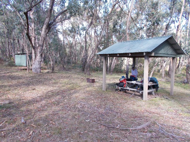
Munderoo Campsite
We had a 6.5km walk to our evening's campsite at Horse Gully Creek in the forest, but it certainly felt longer than that. The bush track behind Munderoo Camp took us down to the creek where we got our water then up past some granite outcrops and then along a track through the forest before we came out onto the bitumen of Munderoo Road. We followed this for about 4km until we turned off onto unsealed Blue Hills Road. Again I had been here before during a past Laurel Hill week and again it has all changed. Notable pine harvesting has given this area a very depressing post apocalyptic look. Arriving at the muddy looking Pascoes Dam we located the track behind it that follows a route through the native forest and alongside Horse Gully Creek. Now I started to get very worried.
Horse Gully Creek was entirely dry. I had last passed this fast running waterway in 2012. If it was like this at the campsite we were going to be in big trouble for our water requirements. The further into the forest we walked the worse it looked, then suddenly we stepped out onto a forest road. In 2012 we had followed this forest road some distance then turned right to ascend steeply past pine plantations to the top of the ridge. Now, we cross the road to follow a new foot track through more native forest on the other side and soon arrived at Horse Gully Campsite. It was 1.55pm and we were greeted with a grassy flat clearing dominated by two benches. Not far away was Horse Gully Creek and it was in full flow with beautiful clear water.
We immediately pitched our tents and tried to create a campfire site, but decided the long grass posed too much of a risk. We settled for a selection of placed logs to create a triple outdoor kitchen cooking area. There was plenty of wood in the forest though and it's obvious this site is rarely used. A pity as it is up there with the spot behind Buddong Hut as being one of the best unofficial campsites on the entire trail. We sat around during the afternoon drinking copious amounts of tea and coffee and watching the birdlife as a huge flock of sulphur crested cockatoos flew over just before dusk. After dinner we sat around as the cockatoos were replaced with bats, then at 7.45pm we were all sent scurrying for our tents as light rain began falling.
It rained all night and the tent leaked in places. Day 19 found me awake at 3.00am listening to the rain outside and mopping up the floor as best I could. I managed to stay dry and somehow slept again until 6.20am and managed to pack up inside the tent. I noticed the others were having a few difficulties with their tents too. The track notes had claimed that the clear waters of Horse Gully Creek turn very cloudy after rain. They weren't wrong, overnight the creek level had risen dramatically and the water was a muddy brown in colour. Once again I was thankful for having the foresight to top up my water requirements the evening before. Like I did at Barrois Camp earlier in the trip, I wrapped my soaking wet tent and strapped it to the outside of my rucksack.
Squizz, Jennifer and I left Horse Gully at 7.40am in heavy pouring rain, thankful for our Gore-Tex jackets. The now wet bush track took us a short distance before bringing us out onto the forest road I had walked along back in 2012 and we walked in the rain through an area of more recently harvested pines and reached the top of the hill just as the rain let up. We turned off the road to follow another bush track before it brought us back to the road. We now walked parallel to the road along the edge of what was once a pine forest. We now had brief views of the countryside to the south and watched as the sun attempted to break through the clouds, only to be thwarted. Eventually we arrived at a fence and used a stile to cross over.
The stile was very slippery and I took a tumble, falling backwards towards the barbed wire, only to be saved by my companions who steadied me and allowed me to get my balance. We noticed all subsequent stiles had chicken wire placed on the logs, this one was the only one that somehow missed out. Just down the track we passed yet another logbook near Carboona Gap and Squizz did his stuff. We now appeared to be descending steeply, but following a ridgeline or spur. The rain came again but only lightly, the track followed a fenceline and levelled out as we found ourselves on a level track walking through grassy countryside. Below us we could see a bitumen road winding its way through the countryside. This we later learned was Jingellic Road on which we had negotiated the narrow road bridge after Mannus Camp. This track was quite delightful, when we weren't dodging cowpats or interrupting cattle who obviously used the track. The views from high up were pleasant, showing hilly countryside and open fields through to mountains in the distance.
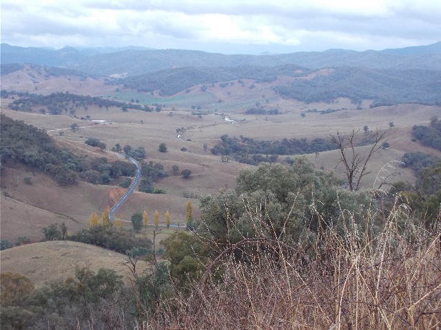
Looking down on farmland and the Jingellic Road from the track as it descends towards the Lankeys Creek Valley
The track eventually descended to reach a farm on Clear Spring Road and we passed the 50km post since leaving Henry Angel Trackhead near Tumbarumba. The white Hume & Hovell signposts had us walking across fields with more cattle to dodge and crossing Coppabella Creek which tested our ability to cross with dry feet. The track took us through woodland above Coppabella Creek and headed for its junction with Lankeys Creek. We now followed the track along the banks of Lankeys for about 3.5km through more farmland. At midday the rain stopped and we found some large logs to sit on and have a 30 minute lunch break.
With lunch over we continued to follow Lankeys Creek until we arrived at the new footbridge across the creek. We crossed, got some photographs taken with the bridge and immediately stepped out onto Jingellic Road which we followed north west for 3km until we arrived at Lankeys Creek Campsite at 1.45pm. The campsite is situated next to the creek on a narrow strip of land beside a small camel farm that boasts Victorian railway carriages as a B&B getaway. There was no sign of the owner, or his camels so we pitched our tents in the camping area as the sun came out to dry them off. The campsite boasts a shelter, fireplace and toilet, but no picnic tables. The shelter has an old lounge chair, so we pulled up an old log so two of us could sit down and we hung an array of wet gear from the shelter to dry.
Just as the tents were dry around mid afternoon it started to rain once again and the tents were soaked yet again, though thankfully not inside. However, we attempted to contact the proprietor of the Train B&B but could only get an answering machine. We were just going to have to deal with the wet and cold conditions at camp. We collected water and got the fire started as the rain finally ceased and we fixed our dinners. I was mortified to find that the YKK zipper on my Goretex raincoat had broken and it's not repairable as it's the bottom teeth on the zip that have broken off. This was to be a trip where I had big zipper issues. Already I had problems with the zip on my tent inner door, the two way zipper only locking one way, which was easy enough to deal with, but worse was to come that night.
Jennifer and Paul pose on the brand new Lankeys Creek Bridge. Photo: I Taylor
It got pretty cold early, even allowing for the heat from the campfire. I retired to my tent at 7.15pm closely followed by the others. As I got into my sleeping bag and pulled the zipper up the zip jammed, as it often did, but this time when I unjammed it, it wouldn't lock and I was left with a broken zipper and a sleeping bag that became nothing more than a down blanket for the remainder of the trip. I couldn't believe the bad luck I was having with these zips, two of which were the normally reliable and almost indestructible YKK type. I was really upset with the state of the sleeping bag. I'd owned this sleeping bag for almost 15 years now and it had done the Overland Track in Tasmania with me. Over the following days at camp my companions and I tried in vain to fix the zip - the sleeping bag now makes a very warm cover for those trips where we camp next to the car. I'm very fortunate to have a couple of spare down sleeping bags at home, but none with the temperature rating this one has.
Day 20 and I was up at 6.20am and exited the tent to greet a wonderful clear blue sky, but it was still very cold. We busied ourselves with breakfast and packed up our now relatively dry tents and moved off at 8.00am. As we moved off my mobile phone rang and it was the proprietor of the Train B&B next door to the campsite returning my call. I informed him that we no longer required his services and he informed me that all bookings are in advance and only for large groups.
I now had to catch up to Squizz and Jennifer as they had continued ahead and I was now a good 300 metres behind them as we made our way along Jingellic Road. I was so intent on catching up to the others that I suddenly realised I hadn't seen any Hume and Hovell track markers. I quickly fired up my GPS and found that we had gone past our turn-off. No one had noticed it in their big hurry and that included me. I was now back in front as we back-tracked to where the GPX file on my GPS stated we had to turn off. The turn-off revealed a post but also signs that stated the area was closed due to pine harvesting. This was the section where a detour has been created to avoid walkers getting in the way of logging machinery. The detour track of about 4km brings you to Tin Mines Road at a gate where you continue the official walk.
We negotiated the gate and were greeted with a signpost that informed us we were entering Woomargma National Park and would be following the unsealed Tin Mines Road. We didn't realise then that we would be following this trail for the next two days. After all the recent rain the road was very muddy and very soon our boots were carrying mud that increased the weight we were carrying. We attempted to walk on the stonier sections of road or on the grass verge as we walked through the forest, but getting rid of the mud was difficult and when we did clear our boots our next steps just picked up more.
We found some fallen logs to sit on in the forest to enjoy morning tea at 9.50am. The Sulphur Crested Cockatoos around here were very noisy and obviously didn't approve of our presence in their territory. The trail became less muddy as it ascended through a forest of ferns, then we found ourselves walking through open eucalypt forest and we stopped for another break. After lunch the sun came and went as clouds rolled in. We continued to follow Tin Mines Road wondering when we would reach Tin Mines Camp. We had two sets of track notes that gave differing distances, 19 and 21km from Lankeys Creek. Both proved to be wrong, as, after coming to a huge grassy area dominated with Eastern Grey Kangaroos, we walked into Tin Mines Camp at 2.40pm where a sign stated Lankeys Creek Campsite was 24km away.
The level grassy campsite has a muddy black road running through it, but it has two toilets, a covered picnic area, two fire places and a water tank that had brown tannin stained water (possibly the worst tank water we had come across so far) Behind the campsite was a large swampy looking area which we found out was the old open cut mine workings, which have since flooded to create the swamp. We wasted little time in getting our tents up and properly dried and utilised my Scrubba washing bag to do some much needed laundry before getting the campfire going. After dinner we played Squizz's dice game then stood around the campfire trying to keep warm until retiring at 8.30pm.
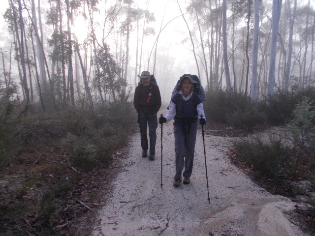
Squizz and Jennifer walking through a foggy landscape just after leaving Tin Mines Camp
I was up at 6.10am next morning. Day 21 was very chilly and I exited the tent to be greeted with fog. It was so thick I could hardly see the shelter 25 metres away. I fixed breakfast and checked my washed clothing to find them still very damp. We were packed up and able to leave Tin Mines Camp at 7.55am continuing to follow Tin Mines Road (now called Tin Mines Fire Trail) as it slowly ascended through the fog and up the slopes of Mount Jergyle. The summit we estimated was 8km away. The fog lifted by 8.30am to reveal the perfect cloudless sunny day.
The ascent got decidedly steeper as we got closer to Jergyle's summit and at 10.05am we arrived at the top and stepped out onto a rocky platform on what is known as Norths Lookout. It was a great chance to dry damp clothes in the morning sun while we enjoyed the views at morning tea. The rising sun was in the way of Mount Narra Narra, but we had excellent views all the way to Canberra (according to the photo-plaque) what we could see was all the way to Holbrook and Albury. We ended up having a 45 minute break where photographs were taken and did some relaxing in the warm sun. Our peace and quiet was then interrupted by some young Holbrook Four Wheel Drive enthusiasts as their vehicles bottomed out on some rocks near the lookout, thus announcing their presence. They joined us at the lookout just as we were getting ready to leave and we swapped information on the conditions ahead. We were told to be on the lookout for a large wrecking ball on the roadside.
The road now headed along a ridge of Mount Jergyle and we got tree interrupted views south towards the alps once again. This road section was about 3.8km long before we started a gradual descent and ascent through private pine forest. We passed an intersection where we saw the wrecking ball. The road was very stony and hard on the feet to negotiate and by now Jennifer had started to slow down. We had a 25 minute lunch break just off the road next to another intersection where again we gave some still damp clothing a final dry in the sun by hanging them off young pine trees and finally got them dry.
Continuing on along Tin Mines Fire Trail the road immediately ascended, even when leaving Murray River Forest and back into the eucalypts of Woomargma National Park. We kept expecting the road to descend as we got closer to our campsite but we kept ascending. Finally, after almost two full days we turned off Tin Mines Trail and ascended South Creek Road and arrived at Samuel Bollard Campsite at the top of the hill at 2.20pm.
Very strange to find a campsite at the top of the hill, but this was a great campsite. It featured a water tank that had clean clear water, a toilet, covered and uncovered picnic tables and a fireplace with plenty of firewood around. We had a search for the Strzelecki boys tent pegs. We certainly had a long hard look, but it was obvious that too much time had passed since they were here. We collected firewood and pitched our tents and prepared our dinners, then sat around the campfire until retiring at 8.00pm.
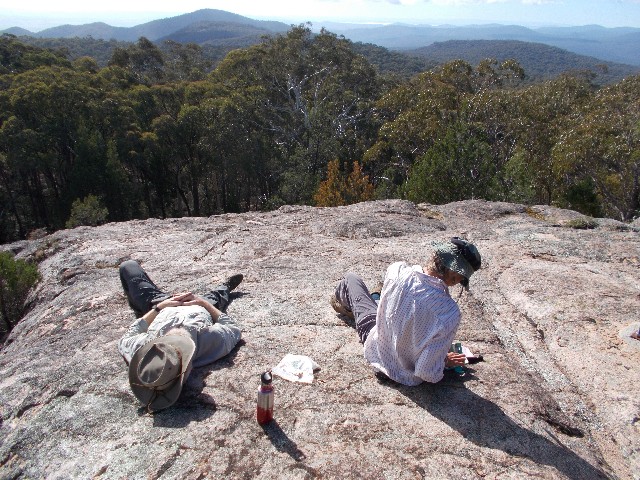
Squizz and Jennifer relaxing on Norths Lookout
It's the 7th of May and day 22 of our trek and I was up in the dark at 5.45am. There was hardly any condensation on the tent and the sky was clear. It was going to be another brilliant sunny day. I fixed my breakfast and then packed up. We needed an early start today as the track notes informed us we had a 26km walk and we got away by 7.10am.
The sign posts had us following a bush track that descended gradually through the forest. We saw side tracks with signage informing us this was "Danny's Loop Walk" before we reached and crossed the bitumen of Tunnel Road. On the other side we ascended gradually and passed around some granite outcrops before the track descended pleasantly before the last steep section to cross Spring Creek before breathlessly ascending the track on the other side. This was pleasant forest, but again, fallen trees forced short detours until we came to a bench with a logbook.
We now turned right and followed a level dirt road for for a couple of kilometres until we made a sharp left turn and followed a trail to a new looking metal wire fence. We now had to follow this fence line for quite some distance. At first there was very little space between the electric fence and the dirt embankment but at the next corner we could see our route following this fence line for some distance as it descended then ascended. Just after the next corner we were faced with a steep drop to the side of the track while our progress was blocked by dumped trees surrounded by stinging nettles. There was no other option but to crawl through a gap under the fence and walk several metres before returning through another gap.
We could see ahead and were faced with yet another steep climb which, at the top, revealed another steep descent beside the fence. The countryside was boring, nothing to see but trees and the scar of the private road beside the fence. We felt like we were circumnavigating the property and started to wonder where this would end. At the bottom of the hill we were faced with a right turn and more fence line walking. Eventually we reached another fence line which we were supposed to cross, but the stile had been removed and was laying upside down on our side of the electric fence. We later worked out that the landowners had removed stiles and stile steps as wild dogs had been using the stiles to gain access to the property to get to the sheep.
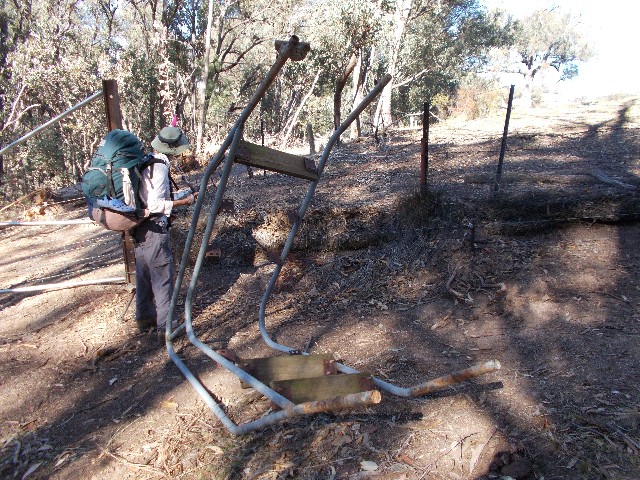
Jennifer contemplates the fence she has to cross with the stile dumped on the trackside
There was no choice but to gingerly negotiate the electric fence. Squizz scrambled over, then Jennifer and I passed over his and our rucksacks before attempting the scramble. We all got over without incident. We now found ourselves at the end of a large field with white Hume & Hovell signposts in the distance showing us the way, still alongside a wire fence. It was serious undulating country but we were glad to see the back of the previous fenceline. The fence we followed revealed the landowners really had issues with wild dogs as there were many sections where holes had been dug under the fence and had to be filled with rocks. Beside these holes there were skeletal remains, either of sheep or the dogs themselves, having been shot by irate farmers.
We continued on, passing a large ancient tree that had fallen and taken root along its trunk. We now gained our first distant view of Hume Reservoir and it was obvious the water level was way down. We stopped for lunch in a small grove of trees, sheltered from the unseasonable heat of the midday late Autumn sun before continuing to cross farmland. We briefly repaired another stile that had its steps removed to cross over, then suddenly we found ourselves leaving the back fence line and cutting across the farmland on a diagonal bearing.
Now we followed the white posts, passing by an old dam and ascending and descending hills and constantly negotiating stiles to cross fencelines. It seemed to go on and on, but after crossing a dry creek on a high wooden foot bridge we descended to reach the bitumen of the Bowna-Wymah Road at 1.45pm. The track notes state that from the edge of Woomargma National Park where we followed the new fence to this very point we have walked 8.4 kilometres. It certainly feels much longer than that. We now have a 7.3km road walk to reach the Great Aussie Resort on the shoreline of the Hume Reservoir, our planned stop-over point for tonight.
Squizz makes his way through farmland near the Bowna-Wymah Road. Photo: J Himmelreich
We turned right and followed the road. Almost immediately Squizz and Jennifer fell behind and at first I slowed my pace so they could catch up. We found a spot to sit on the grass and enjoy a break before continuing. It was a long tiring walk but I was used to doing this kind of walking, having done this as a child and in my youth, hiking back country roads. I was given the all clear by the others to forge on ahead so long as I waited at the next intersection. There was hardly any traffic on the road at all with no more than 5 cars going past during the entire walk. Jennifer was having ankle problems and Squizz was suffering from blisters again but we kept plodding along. Although I was way in front I made sure I kept turning around to see where the others were. If they were not in sight I would wait until they appeared before I continued.
At 3.40pm I arrived at the turn-off for The Great Aussie Resort and waited for the others to catch up. We were now faced with a one kilometre walk from the resort entrance to the site office. Here we booked ourselves into an onsite cabin, grabbed some snacks and drinks from the adjacent shop and made our way to our cabin. The showers were an absolute delight. We settled in to enjoy an early dinner then watched some TV (catching up on events) before retiring to our bunks. We have just two days to go before this walk is completed.
Day 23 found me up at the late time of 6.30am. We all had breakfast and packed our rucksacks, dropping the cabin key off in the honesty box outside reception before leaving the Great Aussie Resort at 7.40am. It was another sunny clear day, but weather reports have stated the day after we finish the weather will change dramatically. We certainly timed this trip well. It didn't take long to reach the Bowna-Wymah Road which we followed, crossing the bridge over Fowlers Swamp Creek. We now crossed the road and turned left and followed the Ten Chain Stock Route.
The Ten Chain Stock Reserve is an area where drovers once plied their trade. The track follows a trail through lightly wooded countryside for about 7km and is very pleasant after all the roads, fences and dirt roads of the past few days. Near the end at a stile is a very good interpretive board with information on the stock route and the story of 'Clancy Of The Overflow'. There are also tantalising glimpses of Hume Reservoir and nearby Tabletop Mountain.
Eventually the trail brings us to a gravel rest area which is the apparent bush camping site we could have stayed at last night. Looking at the long grass, weeds and rubbish I'm glad we had our overnight stay at The Great Aussie Resort. We now stepped out onto the Old Hume Highway and followed the bitumen (again), crossing the Mullengandra Creek bridge with its display of children's toys glued to the hand rails on both sides of the road. We hoped that this display was not a memoriam to someone who had died on this road near here, but sadly we could not find any other reason for the toys. We saw no sign of memorial or cross on the roadside.
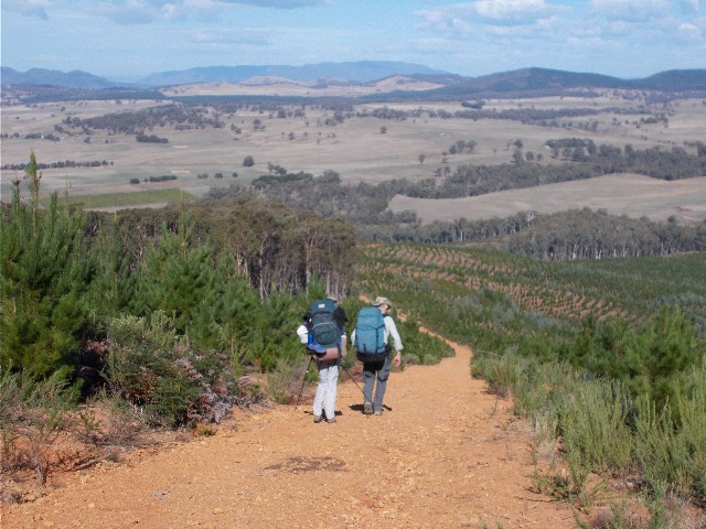
We followed the bitumen for several kilometres, only stopping for a short morning tea break in the grounds of the picturesque pioneer church at 10.30am. Again there wasn't much traffic as we continued towards the intersection with the motorway. By now Jennifer was doing it really tough with her ankle and dropped back. I guestimated that Squizz and I had now walked past the 400km mark since we started this walk almost a month ago. We just couldn't agree on the exact spot. It didn't matter, I was content with the knowledge that we had crossed it some time this morning. Up ahead of us was our turn-off. Thankfully we wouldn't be walking along the edge of the Sydney to Melbourne Motorway, but following a service road for the motorway that ran parallel with it for a couple of kilometres.
Jennifer got very lucky when a kind motorist provided her a lift to our proposed lunch spot at the park below Budginigi Hill. This gave her the opportunity to rest and treat her troublesome ankle. It gave her a couple of hours respite until Squizz and I arrived in time for lunch. Squizz and I now followed another bitumen road and it was totally boring, following an almost straight line for several kilometres with the roaring traffic on the motorway just a few metres away through the trees. It was quite warm now and we soon got a sweat up. Our pace had also quickened as we were really keen to get off the bitumen.
The bitumen ended but we now found ourselves on the unsealed Burma Road, heading south again through countryside that is usually under water when the Hume Reservoir is at capacity. We crossed the road bridge over an almost dry Bowna Creek and continued past fields of inquisitive cattle who followed us as we walked beside their fence. We now had distinctive views of Big Budginigi Hill ahead of us. I was very interested in taking a look at this landmark after seeing some interesting film footage on the Hume & Hovell Track website. I was quite keen on climbing to the top of this small pyramid shaped hill to enjoy the 360 degree views from the trig point.
The road now forks to the right and left and we take the latter option to find ourselves on bitumen again and following Mitchell Road as it ascends beside the lower slope of Big Budginigi. We located a broken section of fence and stepped into a lightly wooded grassy area where we noticed Jennifer sitting at a picnic table patiently waiting for us to arrive. It was 12.50pm and lunch was called for. Squizz and I had taken less than 90 minutes to cover the approximate 10km since Jennifer caught her lift.
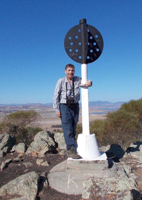
Paul stands by the trig point on top of Big Budginigi
Hill with the receding waters of Hume Reservoir in the distance below.
Photo: J Himmelreich
After we had eaten, we left our rucksacks behind and followed a foot track that allowed us to easily climb to the top of Big Budginigi Hill. As expected the views were sensational. The hill is only 330 metres high, but you can see in all directions for some distance. The better views were of Hume Reservoir to the south east and we took the opportunity to have photographs taken at the trig point before we carefully scrambled back down to our rucksacks.
At 1.05pm we set off again, following Mitchell Road until we arrived at Tabletop Road just over one kilometre later. This road had much more traffic and we passed a camel farm on our right immediately after we had made the left turn. Just over one kilometre away, on a sweeping right bend we turned left to enter Tabletop Park and followed the access road for about 400 metres to arrive at the picnic area and playground that also serves as a camping site.
It is only 2.35pm, so we explored the area trying to pick the best tent spots. We found that the ground was very hard and getting the tent pegs in the ground was almost impossible and I tried several spots before locating some soft ground just next to a line of trees. Our camping area gave us views back to Big Budginigi Hill and to the north Tabletop Mountain dominated the views. The Hume Reservoir was right next to the camping area and just before sunset we took turns in wandering down to the waterline, a fair distance looking at how low the reservoir's water level was. Old fence posts are revealed now the water level has dropped. Our phone signals were strong enough for us to phone loved ones at home and I also called both my parents and daughter.
We cooked our last camp meals as it got dark and we watched the lights of vehicles in the distance, making their way along the old Hume Highway we had walked along earlier today. Some resembled UFO's as they descended a distant hill. We listened to music on my iPad and enjoyed the night sky before the cool conditions forced us into our tents at 8.00pm. It was a cold night, but I was still quite warm with my sleeping bag come blanket. I had also worked out how to keep the tent's inner zip working properly by using the zipper in only one direction. I did manage to tear my sleeping bag liner though. This was very upsetting as I'd had this silk liner since about 2003 and it had always done its job in protecting my sleeping bags from grime and keeping me that little bit warmer. Looks like I'll be doing some equipment shopping after I get home.
I was awake at 5.15am on day 24 of our adventure, Our Final Day was now ahead of us and the finish line almost in sight. It was a very chilly morning as I exited the tent. Again I was greeted by a clear sky, but foggy conditions in the camping area. The fog started to lift as the sky lightened with the coming dawn. We had possibly our biggest day of walking today - in excess of 27km and most of it suburban as we get closer to Albury. I was soon joined by Squizz and Jennifer as I started preparing my breakfast. We were packed up and moving out at 7.10am and our boots were soon soaked with the morning dew from the roadside grass.
The Hume and Hovell posts had us following the busy Tabletop Road south for just over 5km. Occasionally the track would have us walking along the top of cuttings, though some were badly overgrown. We almost missed the turn-off that took us back on the old stock route which followed Nine Mile Creek and utilised spring loaded swinging gates rather than stiles to cross boundaries. These gates were excellent and so easy to utilise, they're the perfect answer to other stile problems elsewhere on the track, especially on farmland where wild dogs are an issue. Once again it was nice to get off the main roads and follow foot tracks, albeit briefly.
Jennifer utilises one of the new swinging gates that have repleced stiles on fencelines during our walk through the old stock route
We soon came to an area were a new subdivision was being created north of Thurgoona and again we had to be reliant on my GPS as the signposts had mysteriously disappeared. We totally missed the Kinross Pub, though this early in the morning it wouldn't be open yet. We crossed the main road where a roundabout was being constructed and somehow noticed a white Hume and Hovell post on the other side. The track now took us through a reserve which we found was part of Sturt University grounds, then came out on a narrow gravel road that passed by several horticultural properties that were obviously part of the university. We followed this tree lined laneway for a short distance and suddenly found ourselves in suburban Thurgoona, an outlying suburb north of Albury.
We followed Hume and Hovell signposts through the streets and located the track through the reserve that backed onto many of the suburb's houses. Here we stopped for morning tea at 10am and Jennifer looked after the rucksacks while Squizz and I took the 500 metre approximate detour to the shopping centre to make purchases from the local bakery. When we returned we enjoyed some comfort food while sitting in the sun and I also took a phone call from Felicity, the Hume and Hovell Track manager, congratulating us on our efforts so far and asking me to contact her when the trip is all over to discuss any issues we had during the walk.
A concrete footpath now took us through the reserve and then through open farm country in an almost straight line south where we crossed onto the Riverina Highway, turned right and walked three kilometres along a footpath that passed the Albury Airport and industrial area and then we turned left onto the access road to Mungabareena Reserve which we had slated down for an early lunch break. Hikers on the Hume and Hovell Track are also allowed to camp overnight at this reserve.
However, we never got to reach Mungabareena Reserve as a Hume and Hovell signpost suddenly appeared on the roadside and directed us onto a foot track that took us briefly alongside the Murray River and around one of its Billabongs. The billabong was smelly and stagnant. Obviously no water movement here in many months. The surface had an algae like skin on it. We then crossed a narrow arm of this billabong using a steel footbridge and almost immediately commenced ascending Albury's East Hill.
The track zig-zagged up the steep hillside, bringing us first to East Hill's trig which of course called for the usual photo opportunities, and then across to Eastern Hill Lookout where we stopped at 12.45pm for lunch. The views from here were excellent and we could see way back to landmarks we had visited in recent days, most notably Big Budginigi Hill and even as far as Mount Jergyle to the north. To the east flowed the Murray River while below us to the west was the main city of Albury.
We now had about 4km to walk and immediately started our descent through Albury's residential streets and crossed the huge footbridge that spans the Motorway, the main southern railway and the old Hume Highway, then we were directed through streets of old houses and businesses before finally we arrived at the busy Wodonga Road and crossed into Hovell Tree Park.
The end of an epic walk - The Hovell Tree beside the Murray River - 440km from our starting point near Yass
We made our way along the banks of the Murray River before arriving at a small picnic area where we located the famous Hovell Tree which William Hovell had carved an inscription into way back in 1824 (Hume's tree had burned down in a bushfire) It was 2.35pm and we had just completed an amazing walk. We dropped our packs by the tree while Squizz talked members of the nearby Fruit Fly Circus (Training nearby in the park) into taking a group photograph of us beside the tree. Our thoughts turned to Julie, who had pulled out of the trip at Tumut with blister problems. She should have been here with us, if only she had used the orange peel on her blisters, she may have been able to continue. I also wondered where the Mayor of Albury was. In recent times the mayor has always greeted 'end to end' walkers as they arrive at this spot and presented them with certificates of achievement.
I wondered why we weren't greeted. We had registered our details prior to the walk with all our times marked in and our approximate arrival time, which was almost spot on. After contacting the track manager later I found out that this exercise had ceased only last year and I was asked if I thought it should be brought back. "Of course" I said, "After walking 440km in 24 days it would be nice for some kind of recognition". I wonder if that will actually happen again in future, though I'm still content in the knowledge that Squizz and I actually completed the walk and we don't need any certificate to remind us of this.
After congratulating each other on our achievement we all set off to our motel rooms, booked nearby, with the promise to meet later that evening for a celebratory dinner and drinks in one of Albury's restaurants. It was time for some fresh clothes and a nice shower before heading home. The next morning we awoke to heavy rain and ice cold conditions as we made our way out of Albury and northwards. We had timed our walk perfectly. One day of wet weather in 24 days, you just can't beat that.
Would I do this walk again? Most certainly, but not for a few years. I'd like to think that in 6-7 years time some of the road sections will have been replaced with foot tracks. There have certainly been improvements in some areas I had visited before this attempt. I am confident of improvements being made in the next 10 years or so and I like to think that in 50 years time there will be very little bitumen or fire trails left to negotiate. Obviously too late for me, but the next generation of bushwalkers should get to enjoy the walk much more than we ever could have hoped for.
I'd like to thank all those who took the time to accompany me on this walk, Sean and Julie Sunley, Julie Davison, Gerald Dodgson, Jacqui Rosier, Jennifer Himmelreich your company on this walk was really enjoyable and I hope I wasn't too fast for you all. A big thank you to Craig Rayner who donated his time to bring us our food drops (Twice) and provide great company on the rest days along with some very thoughtful cold drinks. Last but not least, Ian 'Squizz' Taylor, mate, you excelled yourself. Before the walk many questions came up whether you could complete the entire walk, a point you often brought up yourself, but you never shirked the hard yards and you battled on under some adverse conditions, dealing with blisters late on in the walk. Although I revelled in my accomplishment of completing this walk I was also very happy for your achievement. You were excellent company from day one and you are welcome on any of my future adventures.
Only one big question left. What next? I have a few ideas, but I'll keep those under wraps for now. I have heard however, that there is talk of a new 'South Coast Trek' that is seriously being looked at for coastal New South Wales. Now that sounds appetising.