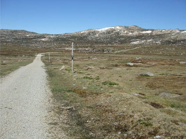
The Summit Trail descends to the Snowy River
On Saturday 21st November 2015 I joined Wayne Puckett for what was originally planned to be a two day walk across the top of Australia - the Mt Kosciuszko Main Range. One of the items on my hiking bucket list was to stand on top of Australia's tallest mountain. We also wanted to take a look at part of the next section in the Australian Alps Walking Track (AAWT) and weigh up the pros and cons of doing the Kosciuszko to Kiandra multi day walk in March next year.
Wayne picked me up at 5.45am on the Saturday morning and we drove from Canberra down the Monaro Highway towards Cooma. Along the way Wayne spoke about his plans for the walk which, after getting to the summit of Mt Kosciuszko, we would follow the main range track toward Mount Sentinel and then follow a negotiable route to Mount Twynam before locating a campsite near Mount Anton. The next day we would double back and follow the Main Range track past Blue Lake and back to the car at Charlotte Pass. An option would be to camp near Blue Lake if we changed our plans. Due to the lack of available water we would be forced to carry all our water requirements today, including our cooking water. We worked out we had just over 6 litres in our rucksacks each which accounts for a massive 6kg in weight. In hindsight, far too much to be carrying.
We stopped at Cooma for 30 minute breakfast at 7.30am before heading out on the Kosciuszko Road, past the Snowy Mountains Airport, through the villages of Berridale, Jindabyne, Smiggin Holes and Perisher Valley before entering Kosciuszko National Park - paying the entry fee of $34.00 and arriving at Charlotte Pass at 8.40am. There wasn't much parking, even at this early stage of the morning. It was very cool outside and there was a stiff breeze, but the sun was shining and there was hardly a cloud in the sky.
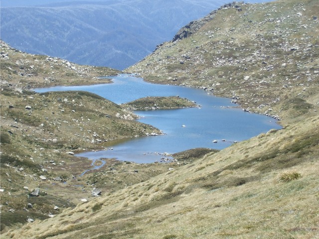
There were two options, take the steep trail down to the Snowy River and walk around the main range or take the Summit Track which would take us to Mt Kosciuszko. It was obvious which one we would be taking and we set off at 8.55am. The Summit Track heads south west and appears to be heading away from the main range, but it loops around to join the main range at Rawson Pass after 8km of steady uphill walking. The trail ascends gradually as you look down onto the Snowy River while the mountains to the north west make for fine viewing with their few remaining snow drifts. These include Muellers Peak, Mount Northcote, Mount Lee and Carruthers Peak. For now, Mount Kosciuszko is out of sight. The trail features a number of tall poles set into the ground and each kilometre is marked. Counting the poles revealed anything from 18 to 22 poles per kilometre which knocked out my guestimate of one pole every 50 metres.
The Summit Trail descends to the Snowy River
Not long after we started walking we caught up to an elderly gentleman with his daypack and trekking pole happily plodding along. Ron is from Tumut and until recently owned the Riverglade Caravan Park there, a place I had stayed at several times in recent years. Ron was also attempting to strike off Mt Kosciuszko from his bucket list. We had a good chat whenever we stopped for a breather or to ease the aching muscles. Our rucksacks with their heavy loads of water certainly slowed me down, but there seemed to be no hurry. Wayne estimated it would take about 2.5 hours to reach the summit of Kosciuszko.
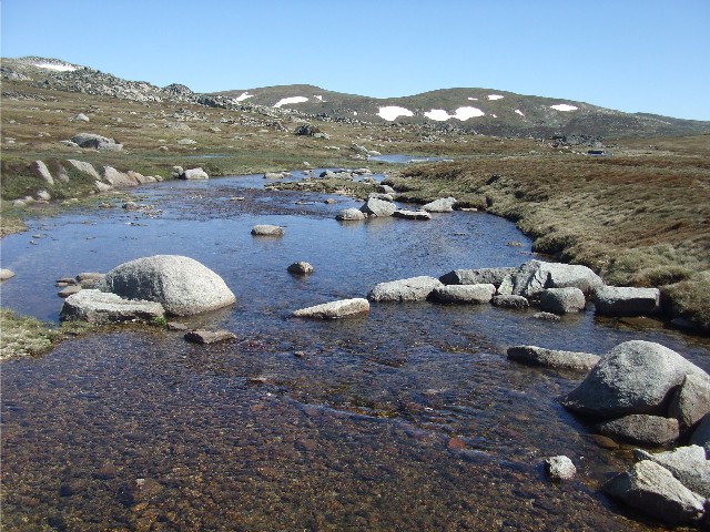
The Snowy River, as viewed from the concrete bridge crossing
The trail descended a short way to the bridge over the Snowy River, then immediately ascended again, gradually to meet Seamans Hut just above the 2000 metre point. Wayne by now had forged ahead, leaving me and Ron to plod along while we chatted and enjoyed the scenery. We finally arrived at Seamans Hut at 10.15am and had a look inside. The structure is small but built of stone which is rare compared to other wood or corrugated metal huts of the high country. It is also the site of a memorial to four young snowboarders who tragically died in a snow cave nearby in 1999. We all signed the visitors book in the hut before heading to Rawson Pass.
The trail now ascends along the edge of Etheridge Ridge and we look down on a small creek that feeds into the Snowy River. We also get our first decent glimpse of Mt Kosciuszko from our track, it's nothing more than a small hill sitting on a high ridge, but it is still Australia's highest point. We arrive at Rawson Pass. This is where the summit track meets up with the trail coming in from nearby Thredbo Village and this is where most of the visitors come from.
We now join the main Kosciuszko track and head north walking through small snow drifts that have crossed the trail to a track intersection about 700 metres north of Rawson Pass. Wayne has been to the Summit of Kosciuszko before so he's quite happy to wait here while Ron and I, without my rucksack, go to claim our own personal moment. The track ascends gradually in a southwards fish hook direction and for the first time during the walk we don't need to take any rest breaks. We arrive at the summit of Mt Kosciuszko at 11.35am to find it expectantly crowded with tourists. Thankfully everyone is getting photographs taken then moving away to let others have their chance. We are standing at 2228 metres above sea level on Australia's highest point. One more removed from the bucket list. Both Ron and I take photographs of each other standing next to the stone structure on the summit. The views are astounding, 300kms in all directions.
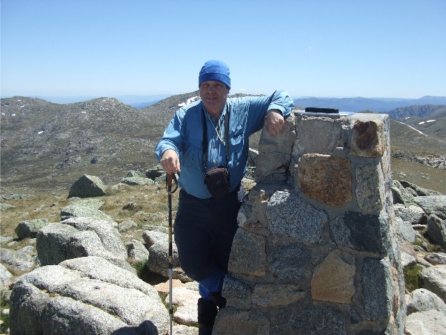
The author stands atop the roof of Australia, The summit cairn on top of Mount Kosciuszko. Photo: R. Pearce
Ron has decided to have his lunch up here before heading back to Charlotte Pass via the way we had just walked in. I shook his hand and promised to get in touch with him next time I'm in Tumut before bidding him farewell and heading back town the trail to join Wayne. I'm having an issue with my left ankle - my boot is rubbing against the bone and it is becoming quite painful. This has happened in the past with these very same boots, but not for a very long time. I got a chance to adjust my boots back at the intersection, then we set off northwards along the Main Range Track at 12.10pm.
It was now a little easier walking - for a while as the track became level or descended gradually as we headed for Muellers Pass. The track along here was a bit rough on the feet, a diamond shaped plastic latticework mat filled with rubble. This soon gave way to slabs of sandstone and later gravel and rock. There were a few spots where we had to negotiate more snow drifts that had crossed the trail and they were certainly more slippery than I expected. Lucky I had my trekking pole for stability. Wayne pointed out Mount Townsend, Australia's second highest mountain at 2209 metres, a view we had on our left side for some distance. Wayne again soon forged ahead while I plodded along. I didn't mind I knew he would be waiting at the next point of interest or track intersection.
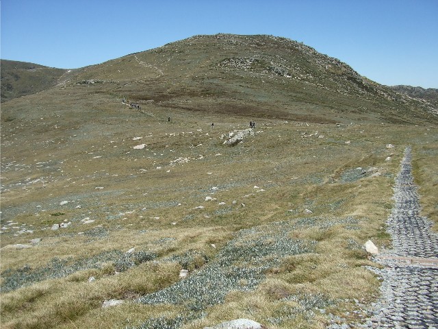
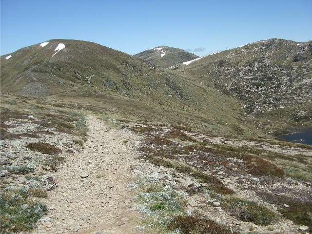
Approaching Mount Northcote on the Kosciuszko Main Range
I was aware of hikers behind me, a large group of tourists who were walking the 21km circuit that starts and finishes at Charlotte Pass. Both Wayne and I would have many friendly chats with members of this group who seemed to fall into the two categories of fast and slow - a bit like Wayne and me. The trail now ascended gradually again as it passed by Muellers Peak then levelled out as it hugged a contour of the western side of Mount Northcote. We looked down on views of scenic Albina Lake. My ankle was feeling much better since I had adjusted my boot laces, but now I was starting to feel queasy in my stomach. I had been careful to drink enough water when I could but now my leg muscles were stiffening up. As a precaution I took a Hydralyte tablet and washed it down with a few sips from my hydration bag. I caught up to Wayne near Mt Lee and stopped for lunch at 1.25pm on a spot above a snow covered slope looking over a valley to the east, not far from a spot above Club Lake.
Approaching Albina Lake
I asked Wayne about our plans after crossing Carruthers Peak nearby and we soon came to the conclusion that the camping sites near Twynam and Sentinel would be quite exposed and in this wind we would likely get blown off the range. He didn't think we would make Mount Anton at the pace I was going and I agreed. Wayne suggested a spot not far from Blue Lake near the ridge on the southern side of the track heading back to Charlotte Pass (Camping is not permitted on the Blue Lake side)
At 1.55pm after a much needed 30 minute break we set off again and started to ascend Carruthers Peak. By now we were joined by many of the tourist group. We had a quick view of Club Lake to the south then faced a steep climb that sapped the energy from your legs and tested the capacity of the lungs. The track on the topographic map really doesn't show it, but the ascent is quite steep. I took many rest stops and passed many others sitting down attempting to catch their breath. They must have thought Wayne and I were mad, climbing this with multi day packs on.
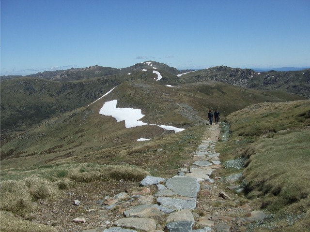
Looking back to Mount Northcote on the left, Mount Kosciuszko in the middle and the lower slope of Mount Townsend to the right
Finally, at 2.30pm, with the muscles in my thighs screaming I caught up to Wayne at the top of Carruthers Peak and took a well earned rest break. There's a trig point up here but I didn't see it as there were so many tourists crowded around getting their breath I just couldn't pick it out. During this 25 minute rest break I sat and admired the scenery around me. I was pleased we weren't heading for Mount Twynam as it incurred much more steep ascending and I felt I had done more than enough ascending for one day, especially with the extra weight on my back. Wayne must have the constitution of a mule, his pack is much bigger than mine yet he just lopes across the countryside like he's on a constant downhill stroll and more amazingly he's only a few months out of major knee surgery.
Looking back to Mount Lee with its snow band during the first part of the ascent up to Carruthers Peak
We set off along with our new found friends for the descent to Blue Lake. It wasn't that far away, just 30 minutes walk and we arrived at the track intersection and a nice grassy spot with a brief view of the lake below us. Despite the descent I felt like I had hit a brick wall and lay down next to my pack for a rest with my hat shading my eyes from the sun. 15 minutes later I got up and not seeing Wayne anywhere, guessed that he had walked down the track to the Blue Lake Lookout. I decided to go take a look myself.
The trail had been reinforced with granite slabs, all dropped in obviously by helicopter in large white bags that were seen at various places on the track. Occasionally small skinks ran from the track and into the undergrowth at my approach. The viewing platform was only about 200 metres down the track and I could see no sign of Wayne. I took a photograph of the lake from the platform then headed back up the slope to my rucksack. I really was getting tired and the 200 metre walk back felt as exhausting as the entire ascent of Carruthers Peak. Wayne had been gathering extra water for camp and when I arrived back I simply told him that I would rather walk out today that try to find a campsite on an exposed windy ridge. Wayne was very sympathetic and understood where I was coming from and agreed we should head out. There was no point in camping out if one of us was not feeling 100% and I certainly wasn't.
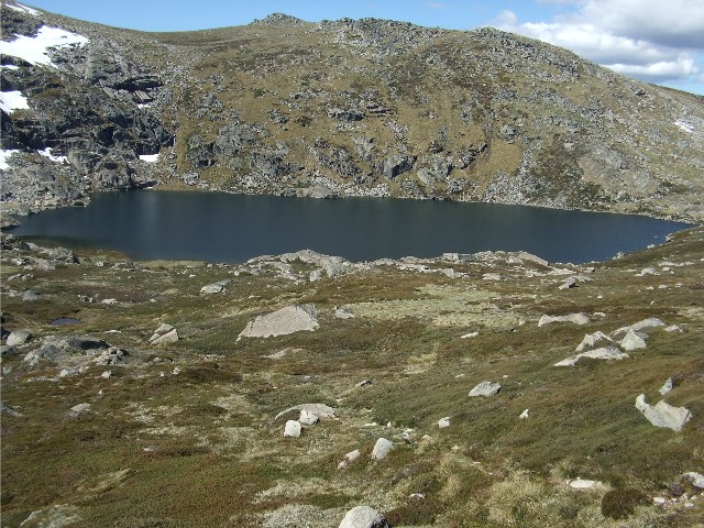
A view of Blue Lake taken from the viewing platform
We moved off at 3.55pm and followed the trail as it made the long descent to the Snowy River. For most of the way I was able to keep up with Wayne, but then I had emptied the 3 litre water bag that held my cooking water so my pack was just a little lighter. We passed the spot that Wayne was considering as an overnight campsite and although there were a few flat spots to pitch tents I was kind of glad we were now walking out. The track now took on a civilised feel as we found ourselves walking on a brick tiled pathway similar to what you might find in a suburban shopping mall. Eventually we reached the Snowy River near where it is met by Club Lake Creek and crossed the two arms of water using large boulders as stepping stones, but on the other side was a sight that I really didn't want to see at the end of a long day's walking - a long brick paved pathway that ascended steeply up the ridge to the car park at Charlotte Pass.
I told Wayne I would see him at the top and off he bolted. By the time I had reached the first bend I had taken 2 rest breaks and was looking for a T bar for a tow. The steepest part of the walk lay ahead and it looked never ending. It was a struggle but I took my time and took rest breaks when I needed them. I finally arrived back at the car park at 5.05pm and gratefully removed my still heavy rucksack, hiking boots and gaiters. Wayne passed me my joggers from the back of his car and they felt so comfortable on my feet. I put my gear in the back of his car and we set off for the drive home. Most of the people we had walked with today had done the 21km main range circuit with day packs. We had just done the same carrying multi day fullpacks weighing in excess of 20kg. During the drive home I suggested to Wayne that our planned multi day Alps Track walk from here to Kiandra in March be postponed until I can do something about why I have now hit the wall on two walks with him this year. The walk was worth it for the bagging of the summit of Kosciuszko though.